The Hike: This is a great hike for car shuttling. Start at the Judge Davis trailhead off of highway 20 and hike up the fire road on the east side of the parking area. (on your right if you are facing highway 20). You initially start uphill, and then reach a fairly steep area. Don't worry, it is only a small climb, and once you reach the top of the ridge is is fairly gentle. You stay on the ridge the entire way, heading south, and eventually drop down to Cache Creek at the confluence of Cache Creek and Bear Creek at Highway 16. You may have to wade accross Bear Creek, depending on the season and how much water is in the creek. A fabulous one-way hike! Distance: 9.5 miles from Highway 20 to Highway 16 at Bear creek, and a total elevation gain of about 1500 feet. If you do the hike from Bear Creek and Highway 16 at the Cache Creek Confluence, up to the pond on the ridge, it is 2.5 miles, one way, to the pond. This hike has a total elevation gain of 1080 feet. |
How to get there: From Yolo county, Woodland and Davis, take Highway 16 through the Capay Valley. As you drive up the Capay valley, be sure to look to your left and try to pick out Berryessa Peak. It is the one with the transmitting towers on the top. Drive up Highway 16 through the Capay valley. Park the first car at the confluence of Cache Creek and Bear Creek, on a dirt pullout on the left side of the road. The confluence is just a few hundred feet from the Yolo County line. Then take the next car all the way to the Highway 16/ Highway 20 intersection. Turn left on Highway 20, and drive about 6 miles, past the vista point. The parking area, known as the Judge Davis parking area, is several miles past the vista point. After you pass the hairpin turn a ways uphill from the vista point, continue up the hill, and over the summit. About 1 mile after the road has been going downhill, look for the tops of the restrooms on the left side of the road. They mark the parking area and the trailhead for the hike. It's a little hard to see due to the recent highway realignment. |
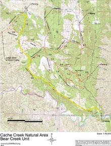
| Map with trail route highlighted (.pdf file) |
 |
GPS track of trail route only (.gpx format) |
 |
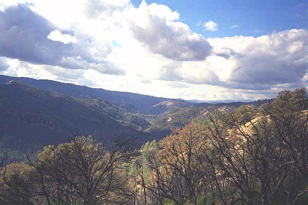
| Photos | |||
 |
 |
||
 |
 |
||
 |
 |
||
 |
 |
||
 |
 |
||
 |
 |
||
 |
 |
||
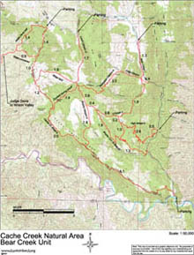
| Map of Cache Creek Natural Area - Bear Creek Unit (.pdf file) |
 |
GPS track (.gpx format) Contains all tracks in the Bear Creek Unit of the Cache Creek Natural Area. |
 |