The Hike: This hike is along a dirt road that leads to the top of of the ridge. Normally, I would hardly consider hiking along a road as being a hike. However, this is no ordinary road. Rayhouse road is closed more often than it is open, making it the perfect hiking area during winter and early spring. It is also a great area to mountain bike, and leads you to some of the most spectacular views in the region (second only to blue ridge). The hike starts the same as the Blue Ridge trail and Frog pond trail. You start out by crossing the low water bridge, and turning right, following the road. Follow the road the entire way up to the ridgeline. Along the way, you will be treated to gorgeous views of Blue ridge, Fiske Creek canyon, and Glascock mountain. The trail winds through blue oak woodland, chaparral and grassland. At the top, you will be treated to 360 degree views, and a view of the entire Blue ridge. Spectacular. From the 4-way intersection of Lang's Peak road, Fiske Creek road, and Rayhouse road, you have the choice of turning back, hiking down to Cache creek along Lang's peak road, hiking to Davis Creek reservoir, or hiking Fiske creek road to the southern Blue ridge trail hike. All of these points are far away, so it is a two day adventure to continue on. I usually just hike back down, my need for great vistas having been satisfied. Distance: 5 miles from the low-water bridge to the Four Corners at the top of the mountain, one way. 1800 foot elevation gain. |
How to get there: From Yolo county, Woodland and Davis, take Highway 16 up the Capay valley. Once you pass the town of Rumsey, you begin to enter the Cache Creek Canyon. The road will narrow and you will be driving with the creek on one side and the canyon walls on the other. When you see the Cache Creek regional park sign on your left, turn into the parking area. This is the lower park site of three that Yolo county runs as park of Cache Creek Regional park. You can park in the parking area, or at a number of pullouts on Rayhouse road, before the gate. Walk down Rayhouse road, past the gate, down to the low water bridge. |
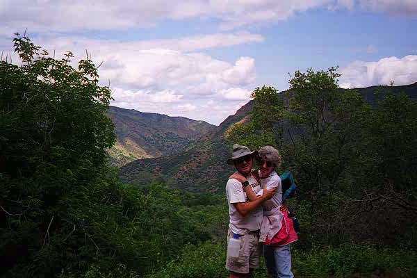
| Photos | |||
 |
 |
||
 |
 |
||
 |
 |
||
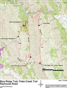
| Map (.pdf file) |
 |
| GPS track (.gpx format) |
 |