The Hike: The 400 acre Big Island has no trails, and is a cross country hike. The Island has three knolls, blue oak woodland, grassland, and some shrubs. I usually traverse the entire island for a hike, starting at the grassland on the southwestern edge of the island, hiking to the northern knoll, then backtracking to the southern knoll. The views of the lake, Blue Ridge, Rocky Ridge, Berryessa Peak, Cedar Roughs, and the rest of the shoreline, are spectacular. The grasses are short bunch grasses on the majority of the island, but the southernmost tip of the island has some star thistle. Avoid that area. One nice thing about the island is that very few people hike on it. Most of the lake's users are boating or water skiing, so there have been days when the lake was packed but I was the only one on the island. On the island, you will see foothill pine, blue oak, buckeye, and manzanita. In the spring, the fields of Lupine are outstanding. |
How to get there: From Napa valley area, take highway 121 to highway 128. Turn left on 128 and drive to Knoxville Berryessa road. Turn onto Knoxville Berryessa Road and stay on the road until you get to Oak Shores Picnic area. Drive to one of the lower parking areas, and take your boat down the hand launch boat ramp. From the Davis and Winters area, take 128 toward Lake Berryessa, turn right on Berryessa Knoxville Road, and follow the rest of the directions above. |
| Photos | |||
 |
 |
||
 |
 |
||
 |
|||
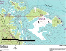
| Map (.pdf file) |
 |
| GPS track (.gpx format) |
| No GPS track available. This hike is cross country on an island. |